BC HighwayCams - Highway 99 (George Massey Tunnel)
Northern, Southern Interior and Vancouver Island images will update every 15 to 30 minutes; Lower Mainland images will update about every two to 15 minutes.
Please note all BC HwyCams use Pacific Time Zone (PT).
 |
|
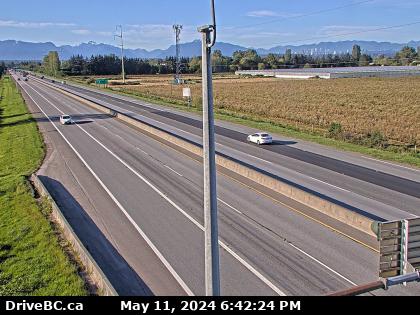
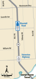
Blundell - N Highway 99 between Blundell Road overpass and Steveston off-ramp, looking north. (elevation: 9 metres)
* View may temporarily change when operators monitor incidents and traffic flow. |
|
|
|
|
Weather Forecast (from Environment Canada) |
 |
|
Works Yard
Highway 99 at Delta Works Yard, looking north*. | Hwy 17A Overpass
Highway 99 from Highway 17A overpass, looking northbound. | Hwy 99 at Hwy 17A - NE
Highway 99 at Highway 17A overpass, looking northeast to 62B/River Road. | Hwy 99 at Hwy 17A - W
Highway 99 at Highway 17A overpass, looking west on Highway 99 at northbound lanes. |
Hwy 99 at Hwy 17A - E
Highway 99 at Highway 17A overpass, looking east at southbound lanes on Highway 99. | Hwy 99 at Hwy 17A - S
Highway 99 at Highway 17A overpass, looking south to Highway 17A. | South Approach
Highway 99 north of Highway 17A overpass, looking north. | Deas
Highway 99 north of Highway 17A overpass, looking north*. |
Steveston
Highway 99 at Steveston interchange, looking north.* | Blundell - N
Highway 99 between Blundell Road overpass and Steveston off-ramp, looking north. | Blundell - S
Highway 99 between Blundell Road overpass and Steveston off-ramp, looking south. |