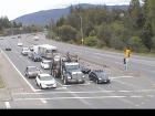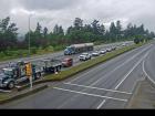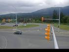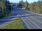
Welcome to the BC HighwayCams website, where you can view highway conditions, traffic, and weather information at a glance.
To view BC HighwayCams, select one of the tabs below and click on a thumbnail. (NR-Northern Region; SIR-Southern Interior Region; LM-Lower Mainland; VI-Vancouver Island; Brdr-Border; All-All webcams; MyCams-Customize your own page of images.)
Please note all BC HwyCams use Pacific Time Zone (PT).
Attention motorists:
Spring weather can make highway conditions in B.C. unpredictable, particularly through high mountain passes. Please be prepared and be aware that winter tires and chains may still be needed.
We reserve the right to restrict travel at any time of the year depending on road conditions.
Click for more information
 | NR |  |  | SIR |  |  | LM |  |  | VI |  |  | Brdr |  |  | All |  |  | MyCams |  |
| |||||||
Highway 1 (Vancouver Island) | |||||||
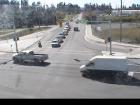
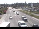
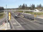
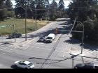
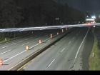 Herd Road - N Highway 1 about 5 km north of Duncan at Herd Road/Cowichan Valley Highway, looking north. |  Herd Road - W Highway 1 about 5 km north of Duncan at Herd Road/Cowichan Valley Highway, looking west. | 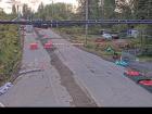 Herd Road - E Highway 1 about 5 km north of Duncan at Herd Road/Cowichan Valley Highway, looking east. |  Herd Road - S Highway 1 about 5 km north of Duncan at Herd Road/Cowichan Valley Highway, looking south. | ||||
 Butterfield Road - N Highway 1 at Butterfield Road, approximately 3 km south of Mill Bay, looking north. | |||||||
 Butterfield Road - S Highway 1 at Butterfield Road, approximately 3 km south of Mill Bay, looking south. |  Bamberton - N Highway 1 south of Mill Bay Rd Overpass at the Bamberton Park Entrance, looking north. |  Bamberton - S Highway 1 south of Mill Bay Road Overpass at the Bamberton Park Entrance, looking south. | |||||
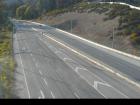 Hwy 1 at West Shore Parkway northbound Highway 1 at West Shore Parkway, looking northbound toward Goldstream Park. | |||||||
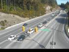 Hwy 1 at West Shore Parkway southbound Highway 1 at West Shore Parkway, looking southbound towards Victoria. | |||||||
Highway 4 | 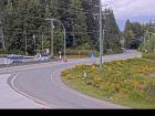 Ucluelet-Tofino Highway - E Highway 4 at Ucluelet-Tofino Highway junction, looking east to Highway 4. | 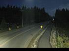 Ucluelet-Tofino Highway - S Highway 4 at Ucluelet-Tofino Highway junction, looking south towards Ucluelet. | |||||
 Taylor River - W Highway 4 about 37 km west of Port Alberni at turn off for Taylor River Rest Area, looking west. |  Taylor River - E Highway 4 about 37 km west of Port Alberni at turn off for Taylor River Rest Area, looking east. |  Highway 4 at Alberni Highway - N Highway 4 at Alberni Highway (Highway 4A) junction, about 2 km west of Coombs, looking north. | |||||
 Highway 4 at Alberni Highway - W Highway 4 at Alberni Highway (Highway 4A) junction, about 2 km west of Coombs, looking west. |  Highway 4 at Alberni Highway - E Highway 4 at Alberni Highway (Highway 4A) junction, about 2 km west of Coombs, looking east. | ||||||
Highway 14 | |||||||
 Hwy 14 at West Shore Parkway - N Highway 14 at West Shore Parkway, looking north to West Shore Parkway. |  Veteran's Memorial Parkway - N Highway 14 (Veteran's Memorial Parkway) at Goldstream Avenue in Langford, looking north. | ||||||
 Veteran's Memorial Parkway - W Highway 14 (Veteran's Memorial Parkway) at Goldstream Avenue in Langford, looking west. |  Veteran's Memorial Parkway - E Highway 14 (Veteran's Memorial Parkway) at Goldstream Avenue in Langford, looking east. |  Veteran's Memorial Parkway - S Highway 14 (Veteran's Memorial Parkway) at Goldstream Avenue in Langford, looking south. | |||||
Highway 17 (Victoria) | |||||||
 Hwy 17 at Saanich Road 1 - N Highway 17 (Blanshard Street) southbound at Saanich Road, looking north. |  Hwy 17 at Saanich Road 1 - E Highway 17 (Blanshard Street) southbound at Saanich Road, looking east. | ||||||
 Hwy 17 at Saanich Road 1 - S Highway 17 (Blanshard Street) southbound at Saanich Road, looking south. | |||||||
Highway 18 | |||||||
Highway 0 (Cowichan Lake) | |||||||
Highway 19 |
New!
|
New!
|
New!
|  Hwy 19 at Port Alice Road Highway 19 at Highway 30 (Port Alice Road) between Port Hardy and Port McNeill, looking south. | |||
 Hyde Creek Road - W Highway 19 about 4.5 km south of Port McNeill near Hyde Creek Road, looking west. |  Hyde Creek Road - E Highway 19 about 4.5 km south of Port McNeill near Hyde Creek Road, looking east. | ||||||
 Woss Highway 19 about 75 km southeast of Port McNeill and 128 km north of Campbell River, looking east. |  Tsitika Highway 19 about 101 km north of Campbell River and about 27 km south of Woss near Tsitika, looking southeast. |  Menzies Hill - N Highway 19 about 7 km southeast of Roberts Lake and 24 km north of Campbell River at Menzies Hill, looking north. | |||||
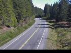 Menzies Hill - S Highway 19 about 7 km southeast of Roberts Lake and 24 km north of Campbell River at Menzies Hill, looking south. | 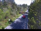 Duncan Bay - N Highway 19 north of Campbell River between Orange Point Road and Duncan Bay Road, looking north. | 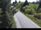 Duncan Bay - S Highway 19 north of Campbell River between Orange Point Road and Duncan Bay Road, looking south. | |||||
Highway 19A | |||||||
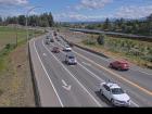 Hwy 19A at 17 Street Bridge - S Highway 19A at 17 Street Bridge in Courtenay, looking southbound on Comox Road. | |||||||
Highway 28 |  Gold River Highway Highway 28 (Gold River Highway) about 24 km west of Campbell River, looking west. | ||||||


